

Map of Claremont Canyon Hike
Claremont Canyon is the largest undeveloped canyon on the western slope of the Berkeley–Oakland Hills. Beginning above the Claremont Hotel and Spa, the 500-acre canyon extends all the way past Grizzly Peak Boulevard. It includes Garber Park, just north and east of the hotel, a city of Oakland park. The East Bay Regional Parks District acquired 208 acres in the lower part to create the Claremont Canyon Regional Preserve, and the University of California owns most of the upper portion.
The park district lists 19 varieties of trees and hundreds of wild flowers and plants, both native and exotic, growing in the canyon — not to mention the lichens and fungi. You’ll also find remnants of the grasslands that once covered the slopes and provided grazing for cattle and horses.
Today, dozens of smaller mammals, rodents, and invertebrates roam the canyon, including the rare rattlesnake, bobcat, and mountain lion. Bird watchers have spotted 130 species, ranging from acorn woodpeckers to yellow-rumped warblers.

Stunning view from to the south, from the top of Claremont Canyon. Photo by Sandy Friedland.
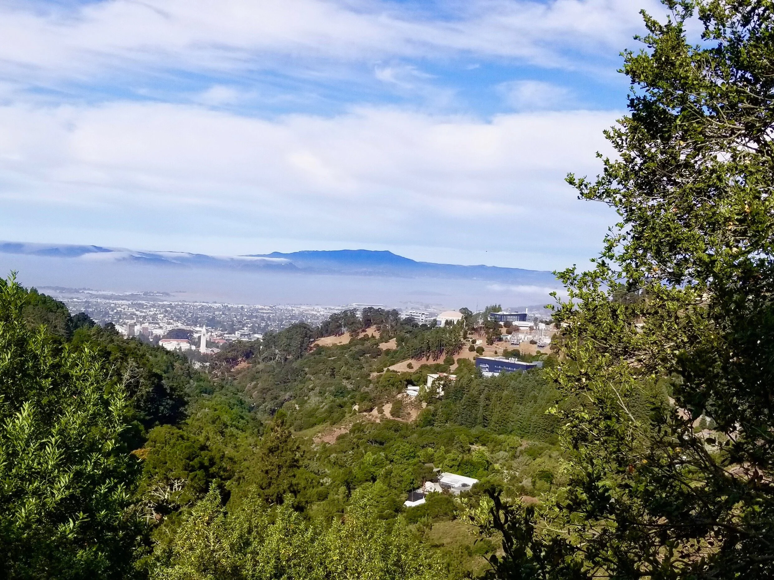
Hiking on the North Side
With its network of trails and fire roads, the north side of Claremont Canyon provides many more hiking options than the other side, but they also are more difficult. Provided you can handle steeper terrain and some uneven footing, however, you’re in for a treat. As an added incentive to explore the area, your dog can tag along off leash.
The most obvious rewards for your efforts are the stunning views from the top.
“On a clear day, looking toward the Bay, you can see all the bridges and flatlands from Fremont to Richmond,” says Marilyn Goldhammer, vice president of the Claremont Canyon Conservancy, who lives on the north side of the canyon. “The sky above the San Francisco is dramatic and always changing. But the view up-canyon is actually my favorite. As you get further away from streets, you feel as though you are in remote, wild country.”
Plotting hikes on the north side of the canyon and beyond poses challenges. Because no trail markers are posted, you need maps. Only some of the trails have names, but those names don’t appear on every map. Mileage figures also differ.
Together, these printable maps are useful guides:
Claremont Canyon Conservancy map.
East Bay Parks map of the Claremont Canyon Preserve.
Tilden to Redwood Regional via Skyline map, which covers more geography and shows how the trails on both sides of the canyon link to many others, including the Bay Ridge Trail.
A 2.5-Mile “Lollipop” Route
By far the most popular trail on the north side of the canyon — and the most difficult — is the breathtakingly steep Stonewall-Panoramic Trail. Starting from the lower end of Stonewall Road, it climbs 800 feet in just three-fourths of a mile. Parts of it are badly eroded, and loose gravel makes others slippery.

Towering pines at the East-West Trail. Photo by Sandy Friedland.
For a far easier, less traveled approach to the north side of the canyon, start at Signpost 28, 1.6 miles above the intersection of Ashby and Claremont avenues or half a mile below the intersection of Claremont and Grizzly Peak.
You’ll find a small parking area and a Claremont Canyon Conservancy map. The following 2.5-mile “lollipop” route begins there and will introduce you to this side of the canyon.
Head up the moderately steep hill, passing stands of bay laurel and oaks with second-growth eucalyptus trees towering above them. Imported from Australia in the early 1900s in the mistaken belief that they would make good timber, the eucalyptus soon were abandoned. They froze in the unusually cold winter of 1972-73 and were cut down. However, their stumps soon regenerated multiple trunks, which you’ll notice along the trail. These highly flammable trees now crowd out more fire-resistant native species.
Atop the hill is a four-way intersection. Turn left onto the East-West Trail, and continue for about 0.8 mile. Lined with chaparral and conifers, this trail soon offers magnificent views of the entire Bay Area. You’ll descend one hill and soon come to a longer and steeper one. You can choose a more gradual descent by veering left onto a narrower, parallel path.
At the bottom of the hill, look immediately for a cutoff on the right. Head down this gentle hill to reach the Upper Jordan Trail. Turn right onto this wide, flat fire road that overlooks Strawberry Canyon and the UC campus. A favorite of runners, this trail not only would provide firefighters access to a blaze but also would serve as a firebreak itself.
Continue for about a mile, passing a bench, until you come to an uphill cutoff on the right. Take this path up to the four-way intersection. Cross the East-West Trail to return back down to on the same trail you took up from Signpost 28.
************************************************
A version of this article first appeared in the November issue of Claremont-Elmwood Social magazine.
To learn more about Claremont Canyon, including its history, its flora and fauna, and the risks of wildfire, see the website of the Claremont Canyon Conservancy. The group also sponsors guided walks and volunteer work parties.